Transportation Master Plan
What is a Transportation Master Plan (TMP)?
A Transportation Master Plan (“TMP”) is a long-term plan that will help guide the development and expansion of the District Municipality of Muskoka’s (“District”) transportation network and system for the next 30 years and beyond. The TMP will outline strategies and policies that support planned growth within the District that aligns with the future vision of the transportation system. Key infrastructure projects to be implemented over the next several years will be identified as part of the plan. These infrastructure projects will support travel throughout the District whether that is by driving, walking, cycling, or other modes of transportation.
Why is this study being undertaken?
The District Municipality of Muskoka region is growing and changing. Within the next 30 years, more people are anticipated to move here, there may be more ways people want to travel and move around the area, and more visitors are expected to take in the landmarks and sights that the District has to offer. With this growth and changing travel demands, the District wants to ensure the roads and transportation systems can handle this growth safely and efficiently. Therefore, this TMP will look into:
- Planning for better roads and connections between communities,
- Making sure the transportation systems work well for everyone, including residents, businesses and visitors,
- Making sure the infrastructure to support a variety of transportation modes are available where it is most needed.
What will this study look at?
The TMP will focus on a variety of topics to improve the transportation system, including:
- Road Identity: Determining primary intents and purpose of a District (or regional) Road Network.
- Road Safety: Making sure roads are safe for everyone, whether you are driving, walking, or cycling.
- Traffic Flow: Reducing traffic congestion and improving how traffic moves throughout the District.
- Road Network Connectivity: Analyzing if the road network is connecting our residents to the services they rely on (including such considerations as suitable alternative detour routes for emergencies.)
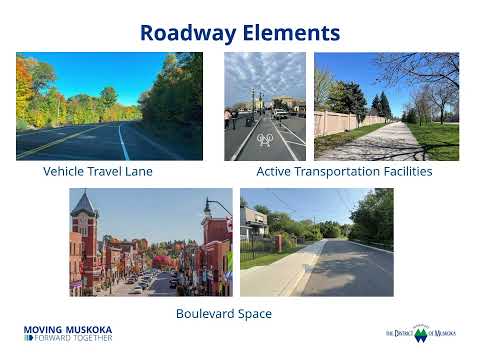
- Active Transportation: Supporting walking, cycling, and other non-motorized forms of travel.
- Alternative or Emerging Mobility Options: Considering how the use of alternative or emerging mobility options, such as electric scooters (e-scooters), snowmobiles, low-speed vehicles, and all-terrain vehicles (ATVs) interact with the transportation network
- Environmental Impact: Ensuring that infrastructure is planned for while protecting the natural landscapes of the District Municipality of Muskoka region.
Check out our interactive map of District Roads, where you can leave comments regarding specific roads that reflect your interests, priorities, and concerns.

Have thoughts or ideas? Book a virtual meeting with us, we'd like to hear from you!

-
Pop-up Events: Summer 2025
Share Pop-up Events: Summer 2025 on Facebook Share Pop-up Events: Summer 2025 on Twitter Share Pop-up Events: Summer 2025 on Linkedin Email Pop-up Events: Summer 2025 link
Who's Listening
-
Project Manager

Phone 705-645-2100 Email TMP@muskoka.on.ca
🚗Book a virtual meeting 🗣️

Let's chat! Click here to book a meeting.